Getting Around London: A Comprehensive Guide to London’s Public Transport System
London’s public transport system offers an extensive network of interconnected services, including the iconic Underground, extensive bus routes, Overground trains, and the Docklands Light Railway.
- London's Public Transport Network: A Comprehensive Guide
- The London Underground
- The London Overground
- The Docklands Light Railway (DLR)
- London National Rail Services
- Getting Around London Using London Buses
- London's Public Transport System: The London Tram Network
- Getting Around London Via The Emirates Air Line (Cable Car)
- Getting Around London Via Thames Clippers
- Hailing London's Iconic Black Cabs
- Cycling in the City: Santander Cycles (Boris Bikes)
- Walking in London: The Often Overlooked Transport Option
- Accessibility in London's Public Transport System
- Smart Travel: Ticketing and Payment Options
- Planning Your Journey: Tools and Resources
Visitors and residents can navigate the city efficiently using Oyster cards or contactless payments, which provide cost-effective travel across various fare zones.
The system extends beyond central London, connecting outer boroughs and suburbs through National Rail services and the Emirates Air Line cable car.
Thames Clippers offer scenic river transport, while cycling and walking provide eco-friendly alternatives. With numerous options available, understanding the intricacies of each service can greatly enhance your London travel experience.
London Public Transportation in Summary
Hide- The London public transport system is vast and complex, but choosing the right mode of transport can make a big difference to your travel experience 🚂
- The city is divided into nine fare zones, with zones 1 and 2 being central London and increasing in number the further outside the city you get 🗺️
- There are various ways to pay for transport in London, including buying an individual ticket, using a contactless card, an Oyster card, a visitor Oyster Card, or purchasing a travelcard 💳
- The London Underground or "Tube" is the oldest underground metro network in the world, carrying over a billion passengers a year across 270 stations and 250 miles of track 🚇
- The Overground is a rail system that operates above ground, created in 2007 to fill in coverage gaps in the Underground system, with the same fare pricing as the Underground 🚂
- The Docklands Light Railway is an automated rail system that covers the docklands area of London, with a fully automated system and no drivers 🤖
- Thames Clipper is a fast and scenic way to travel along the River Thames, offering a fun alternative to traditional transport 🛥️
- London buses are an affordable way to get around the city, with a fixed fare of £1.75 for a single journey, and a "hopper" fare that allows you to change buses without paying extra 💸
- The tram service in south London is a convenient way to get around, running between Wimbledon, Croydon, and Beckenham 🚋
- London has a cable car service that offers panoramic views of the city as you cross the River Thames, a unique way to travel 🚡
- Cycling is a great way to get around London, with public cycle points all around the city, and a convenient bicycle hire system 🚴
- Walking is a pedestrian-friendly way to explore London, especially in central areas, and is often a quicker option for shorter distances 🚶
- Accessibility in London's public transport system varies, with buses and trains generally more accessible than the Tube 🚪
- Planning your route and travel time is essential to navigating London's public transport system effectively 🗓️
- London's public transport system includes the Underground, buses, overground trains, DLR, and river services.
- Oyster cards and contactless payments offer the best value for travel across multiple transport modes.
- The Underground (Tube) is extensive, with 11 lines covering 402 km across London's fare zones.
- Buses provide cost-effective 24-hour service with flat fares and extensive route coverage throughout the city.
London’s Public Transport Network: A Comprehensive Guide
London’s extensive public transport network is divided into fare zones, which determine ticket prices for various journeys.
Understanding these zones is essential for visitors and residents alike, especially those who are visiting London for the first time, as it helps in planning cost-effective travel across the city.
The network encompasses multiple transport options, including the iconic Underground (Tube), buses, overground trains, and river services, each offering distinct advantages for traversing different parts of the metropolis.
Check your visa requirements with our 100% free Travel Visa Requirements Checker tool, powered by extensive machine learning data.
Understanding London’s Fare Zones and Transport Options
London’s extensive public transport network is divided into fare zones, which determine ticket prices for journeys.
The system comprises various modes of transportation, including the iconic Underground (Tube), buses, overground trains, and river services.
To navigate this network efficiently, visitors and residents can choose from several payment options, such as Oyster cards and contactless bank cards, which offer convenience and often provide better value than traditional paper tickets.
A Brief Overview of London’s Public Transport System
With its extensive network of buses, trains, and underground lines, the public transport system in London offers visitors and residents alike a thorough and efficient way to navigate the sprawling metropolis.
The Transport for London (TFL) network includes:
- The iconic London Underground (Tube)
- Overground trains
- Buses
This all-encompassing system enables seamless travel across the city, providing freedom to explore diverse neighborhoods and London attractions.
Understanding London’s public transportation options empowers travelers to make the most of their London experience, especially during a family trip to London when you bring your kids or parents.
How to Pay for Transport in London: A Guide to Oyster Cards, Contactless Cards, and More
Maneuvering London’s public transport payment system requires understanding the various options available, including Oyster cards, contactless payments, and fare zones.
The London travel pass offers flexibility, while Oyster cards provide cost-effective solutions for frequent travelers.
Contactless payments simplify transactions on the London Underground.
Prices vary based on zones traversed.
Mastering these options guarantees efficient navigation of London’s extensive public transport network, granting visitors and residents alike the freedom to explore the city seamlessly.
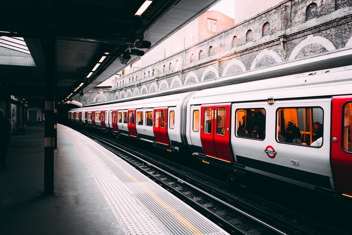
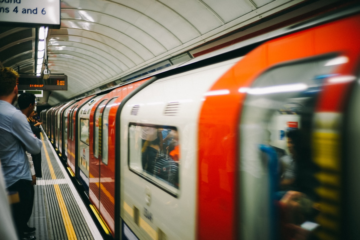
The London Underground
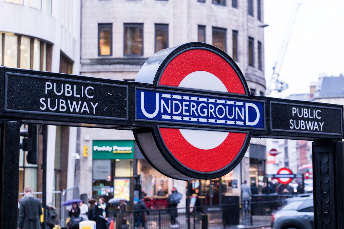
The London Underground, colloquially known as ‘the Tube,’ is an essential component of the city’s public transportation system.
This thorough guide will equip travelers with the knowledge needed to navigate the extensive network of underground trains efficiently.
From understanding the iconic Tube map to purchasing the right ticket and mastering platform etiquette, this information will guarantee a smooth journey through London’s subterranean transit arteries.
A Guide to Using the London Underground
The London Underground, commonly known as the Tube, is an essential transportation network with a rich history dating back to 1863.
To navigate this extensive system efficiently, tourists and locals alike can benefit from a step-by-step guide that covers everything from purchasing tickets to understanding the color-coded lines.
Additionally, seasoned travelers offer valuable tips for using the Underground, including strategies for avoiding rush hour congestion and maximizing the overall experience.
History of the London Underground
Since its inception in 1863, the London Underground has revolutionized urban transportation, becoming the world’s oldest underground railway system and an essential part of the city’s infrastructure.
The London metro, also known as the Tube, has evolved considerably:
- Expanded from a single line to 11 lines covering 402 km
- Introduced the iconic Tube map in 1931
- Developed the Oyster card system for easy travel
How to Use the London Underground: A Step-by-Step Guide
While the London Underground‘s history is fascinating, mastering its use is key for efficient travel in the city today.
The best way to get around London is by understanding its public transportation system, particularly the Underground.
Familiarize yourself with London travel zones, purchase an Oyster card, and download a tube map app.
Traveling in London becomes seamless when you grasp the intricacies of public transit in England’s capital.
Using the London Underground, also known as the Tube, can be straightforward with some basic knowledge and preparation. Here’s a step-by-step guide:
1. Understanding the Map
- Divisions: The London Underground is divided into nine travel Zones, with Central London covered by Zone 1 and the outer zones extending up to Zone 9.
- Lines: There are 11 different lines, each color-coded for easy identification. Signs at stations will display both the line name and its color.
2. Buying Tickets
- Options: You can buy paper tickets, Oyster Cards, or use contactless payment cards. Oyster and contactless payments are generally cheaper than cash.
- Using Barriers: Insert your paper ticket or tap your Oyster/Contactless card on the yellow pad next to the green arrow sign on the barrier. The barriers will open to allow you to pass through.
3. Navigating Stations
- Interchange Stations: Stations where you can change between different lines are marked with a white circle with a wide black outline. The routes between lines will be signposted.
- National Rail Interchanges: Stations that interchange with National Rail have a red symbol next to them.
4. Reading Signage
- Exit Directions: Once you arrive at your destination, look at the wall in front of you for signage indicating which direction to go to change lines or exit the station. Different exits may be marked for specific destinations or points of interest.
5. Using Technology
- Apps: Consider using the Tube Exits app to plan your journey, determine which carriage to enter, and receive live status updates.
6. Practical Tips
- Rush Hours: Avoid traveling during rush hours (7-9 am and 5:30-7 pm) if possible, as the Tube can be very busy.
- Escalators: Stand to the right on escalators to allow people in a hurry to pass on the left.
- Platform Safety: Stand behind the yellow line on the platform to avoid incidents involving the train and platform edge.
- Accessibility: Look for blue circles with white figures in wheelchairs on the map to identify step-free access stations. Some platforms may be accessible in one direction but not the other.
7. Additional Tips
- Offering Seats: Always offer your seat to unwell, elderly, pregnant, or traveling with small children passengers.
- Holding Rails: Hold onto the rails while standing to avoid being jerked about by the train.
- Safety Awareness: Be aware of your surroundings and keep hold of your belongings to avoid pickpocketing or theft.
By following these steps and tips, you can navigate the London Underground efficiently and confidently.
Tips for Using the London Underground: Avoiding Rush Hour and More
Maneuvering the London Underground efficiently requires more than just understanding its routes; seasoned travelers employ several key strategies to optimize their journeys and avoid common pitfalls.
Consider these tips:
- Plan journeys outside peak hours (7:30-9:30 AM, 5-7 PM)
- Use contactless payment for faster entry
- Stand on the right, walk on the left on escalators
These tactics guarantee smoother travels and maximize your independence while maneuvering London’s bustling transport system.
The London Overground
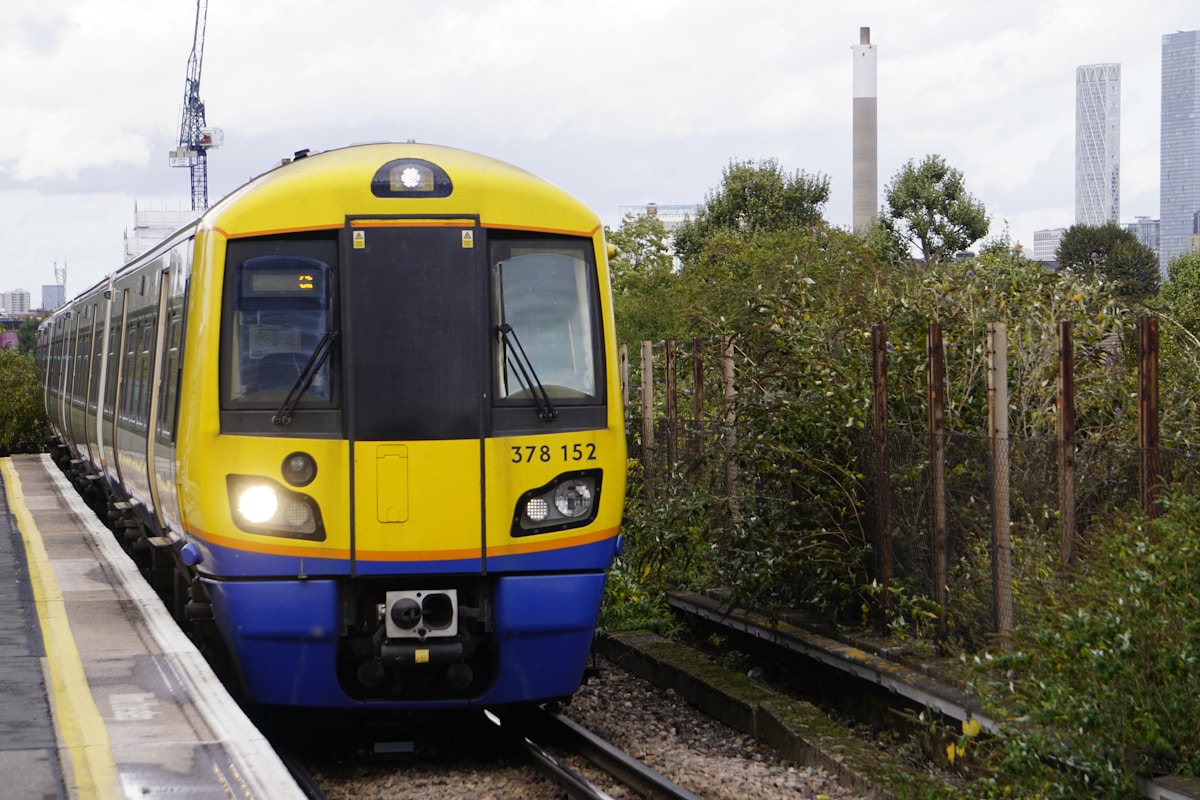
The London Overground is a suburban rail network that complements the Underground system, providing additional connectivity across the city.
Operated by Transport for London, it consists of six lines that form an orbital route around the capital, connecting outer boroughs and offering interchanges with other rail services.
The Overground uses a combination of existing railway lines and newly constructed sections, with distinctive orange-branded trains running frequently throughout the day and accepting the same payment methods as other TfL services.
What is the Overground and How Does it Work?
The London Overground is an essential component of the city’s public transportation network, offering an above-ground rail service that complements the Underground system.
Unlike the Tube, the Overground primarily serves outer London boroughs and connects various parts of the city with its distinctive orange-branded trains.
Understanding the key differences between the Overground and Underground, as well as mastering the use of the Overground system, can considerably enhance a traveler’s ability to navigate London efficiently.
A Guide to Using the Overground
London’s extensive rail network includes the Overground system, an essential component of the city’s public transportation infrastructure that complements the Underground and offers convenient connections across Greater London.
To effectively navigate the Overground:
- Download the TfL app for real-time updates
- Use contactless payment for seamless travel
- Check service status before your journey
The Overground’s expansive reach empowers travelers to explore diverse London neighborhoods with ease, providing a cost-effective and reliable alternative to traditional tube routes.
Key Differences Between the Overground and Underground
While both serve as essential components of London’s transit system, the Overground and Underground differ markedly in their operational characteristics, network coverage, and passenger experience.
The Overground primarily operates above ground, serving outer London areas, with less frequent trains and newer, more spacious carriages.
In contrast, the Underground’s extensive subterranean network covers central London, offering higher frequency service but often more crowded conditions during peak hours.
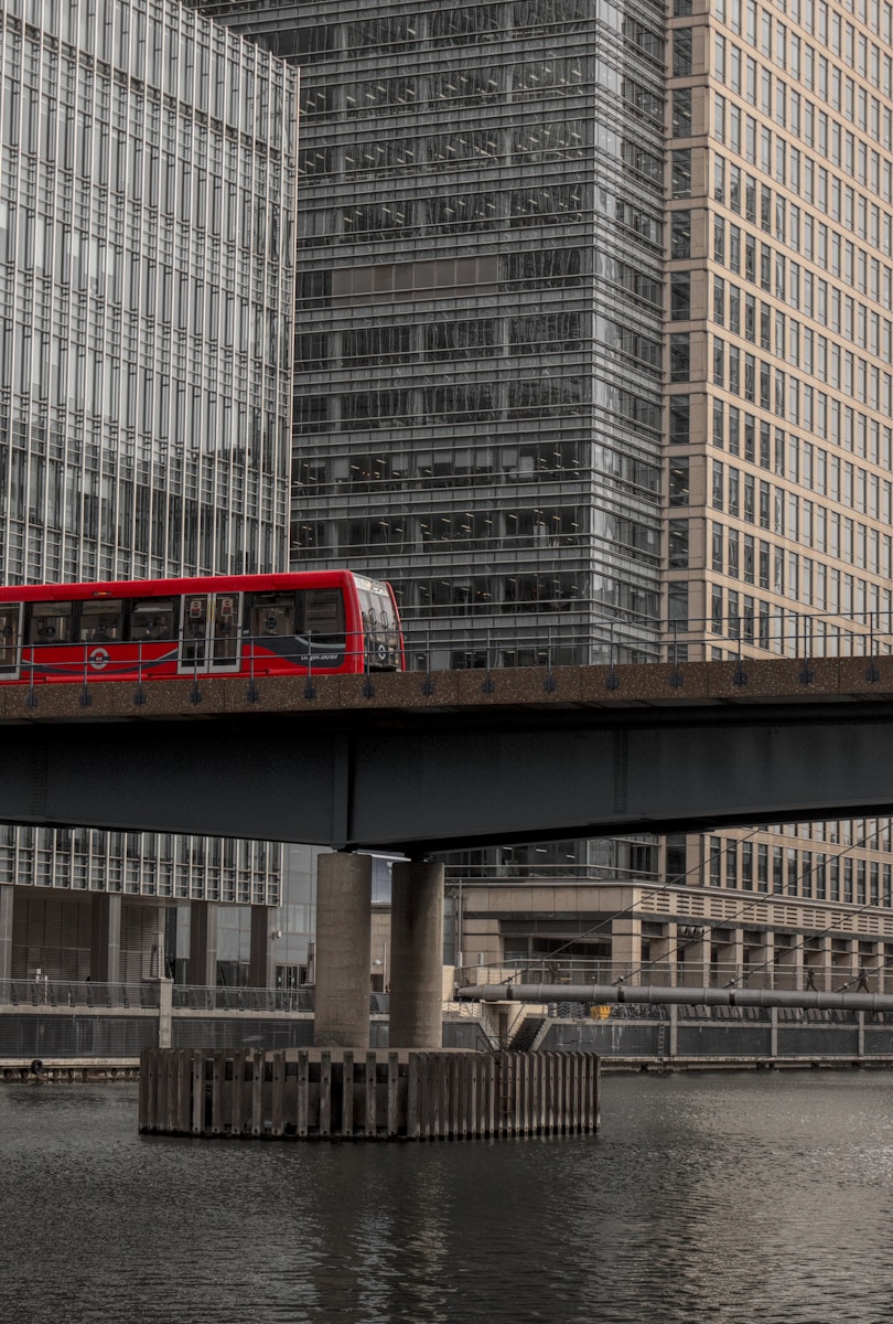
The Docklands Light Railway (DLR)
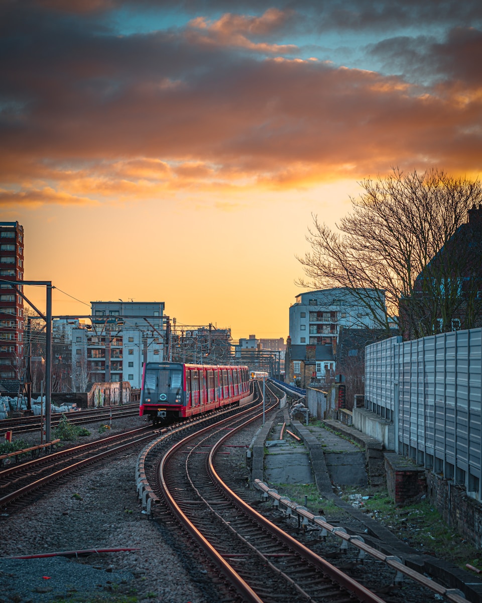
The Docklands Light Railway (DLR) is an automated light metro system serving London’s Docklands area and beyond.
Operating without drivers, the DLR uses computer-controlled trains that run on dedicated tracks, offering frequent and reliable service to key destinations in East and South East London.
This modern transit network seamlessly integrates with the London Underground and other transport modes, providing essential connectivity to major business districts, residential areas, and London City Airport.
What is the London DLR and How Does it Work?
The Docklands Light Railway (DLR) is an automated light metro system serving the redeveloped Docklands area of East London.
This guide will outline the essential steps for using the DLR, including how to purchase tickets, navigate the stations, and board the driverless trains.
Additionally, we will explore the key advantages of choosing the DLR for your London travels, such as its frequent service, extensive coverage of East London, and seamless integration with other Transport for London services.
A Guide to Using the London DLR
Maneuvering London’s extensive public transportation network becomes even more efficient when you understand how to use the Docklands Light Railway (DLR), an automated light metro system serving the redeveloped Docklands area of East London.
To use the DLR effectively:
- Purchase an Oyster card or contactless payment card
- Check the destination board for your train
- Board at any door; no need to hail the driverless train
Key Benefits of Using the DLR
While traversing London’s extensive public transportation system, travelers can benefit considerably from utilizing the Docklands Light Railway (DLR), an automated light metro network that offers unique advantages for efficient and convenient travel in East London.
The DLR provides quick access to key business districts, seamless connections to other transport modes, and frequent service with minimal delays.
Its driverless operation guarantees reliability and punctuality, enhancing the freedom of movement for passengers.
London National Rail Services
National Rail services play a vital role in London’s transportation network, connecting the city to destinations across the United Kingdom.
These services operate from major terminals such as Waterloo, King’s Cross, and Paddington, offering both local and long-distance travel options.
Understanding how to navigate the National Rail system is essential for visitors and residents alike, as it provides access to suburbs, neighboring cities, and even international connections via the Eurostar.
A Guide to Using National Rail Services in London
National Rail services offer an efficient way to traverse London and connect to other parts of the UK.
Understanding how to use these services, from purchasing tickets to guiding through stations, is essential for both residents and visitors.
The key benefits of National Rail, including extensive coverage and frequent departures, make it a valuable option for those seeking to explore beyond central London or commute from surrounding areas.
How to Use National Rail Services: A Step-by-Step Guide
London’s extensive National Rail network offers travelers an efficient means of traversing the city and its surrounding areas, connecting major stations and providing access to numerous destinations across the United Kingdom.
To navigate this system effectively:
- Plan your journey using online tools or apps
- Purchase tickets in advance or at station kiosks
- Locate your platform using departure boards
Using National Rail services in London involves understanding the network, purchasing tickets, and navigating the stations. Here’s a comprehensive guide:
1. Understanding National Rail in London
- Network: National Rail connects London with the rest of the UK. When daytripping out of London or moving to other points in the UK, you’ll need to use National Rail services.
- Separate Train Operating Companies (TOCs): National Rail is a network of many separate TOCs. You’ll see the double red arrow logo with the name of the individual TOC, identifying it as part of National Rail.
2. Buying Tickets
- Options: You can buy tickets from machines at stations, ticket offices (though not all stations have them and they’re not open all the time), or in advance from the Visitor Shop.
- Types of Tickets:
- Single or Return Fares: For journeys to specific stations without stops.
- Travelcards: For unlimited travel on the Tube, trams, Docklands Light Railway (DLR), and London Overground services, as well as some National Rail services within the London travel zone. Available for 1 day or 7 days.
- Oyster Cards: Plastic smartcards that can be used instead of paper tickets. They automatically work out the cheapest rate for every journey and have a daily price cap. Oyster Cards can be used on all buses, underground, overground, and tram services.
3. Navigating Stations
- Station Types:
- Regular Stations: Represented by a line on the map. No line changes are possible at these stations.
- Interchange Stations: Represented by a white circle with a wide black outline. You can change between lines at these stations. The routes between lines will be signposted.
- National Rail Interchanges: Stations that interchange with National Rail services have a red symbol next to them.
4. Using Trainline for Booking
Trainline App/Website: A rail booking service that makes it easy to type in your departure point and destination. It provides different options for your London trip, allowing you to prioritize speed, price, or split destinations.
You can easily book the ticket and use it on your phone by tapping in at the station. Trainline charges a small service fee but offers convenience and simplicity, especially for overseas customers.
5. Additional Tips
- Planning Your Journey: Take the time to plan your journey beforehand, including any changes you might need to make. Many stations only serve one line, so ensure you know which stations are the correct ones to change at.
- Station Maps: Grab a Tube map or check the big maps at the entrance of every station. Each train also has maps of the line it travels along plastered on its walls.
- Digital Signs: Platforms have digital signs displaying what train will be arriving next, where it is going, and how long until it arrives. The train itself will also have its destination on its front and usually announce the line once you are onboard.
By following these steps, you can efficiently navigate National Rail services in London.
Key Benefits of Using National Rail Services
Frequently overlooked by tourists and locals alike, the extensive National Rail network offers numerous advantages for travelers traversing London and its surrounding areas.
These benefits include:
- Wider coverage beyond central London
- Often faster than Underground for longer journeys
- More spacious and comfortable carriages
- Scenic routes through picturesque countryside
- Access to charming towns and villages
- Flexibility to explore beyond the city limits
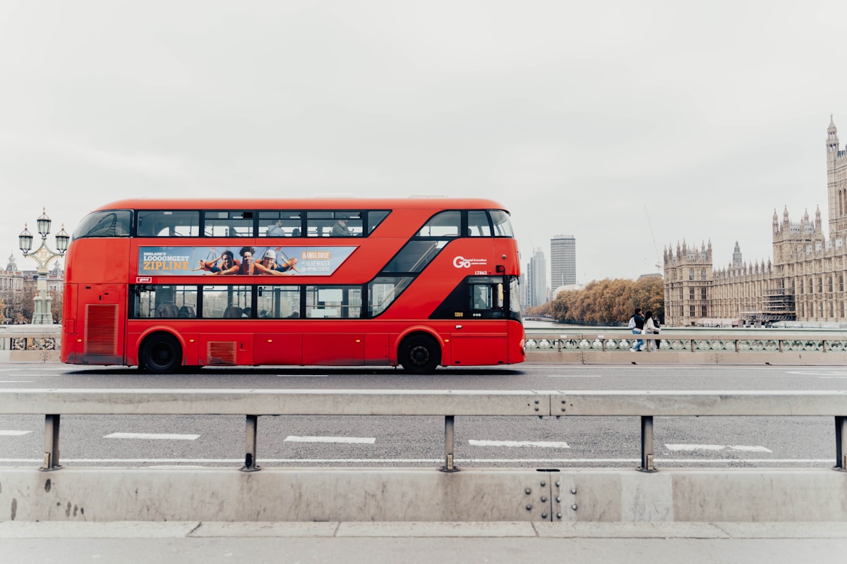
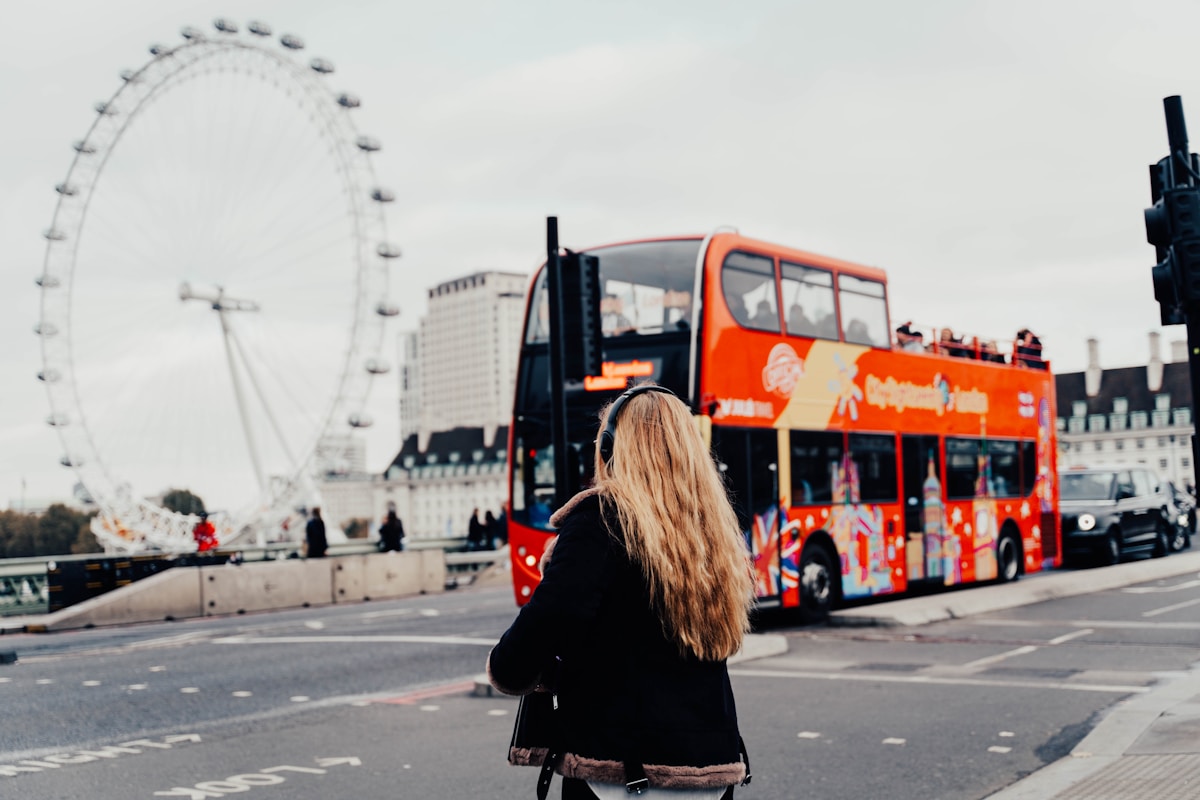
Getting Around London Using London Buses
London’s iconic red buses form an integral part of the city’s public transportation network, offering a wide-ranging and affordable way to navigate the capital.
With over 700 bus routes covering all areas of London, this thorough system operates 24 hours a day, providing both regular daytime services and night buses.
Understanding how to use London buses effectively can greatly enhance a visitor’s or resident’s ability to explore the city efficiently and economically.
A Guide to Using London Buses
London’s extensive bus network offers an efficient and cost-effective way to navigate the city.
This guide will provide a step-by-step walkthrough on how to use London buses, ensuring you can confidently board and travel to your destination.
Additionally, we’ll explore the key advantages of choosing buses as your primary mode of transportation in London, including their extensive coverage and frequent service.
How to Use London Buses: A Step-by-Step Guide
Maneuvering London’s extensive bus network can seem intimidating at first, but with this all-encompassing guide, you’ll soon be traversing the city like a local.
Using London buses is straightforward with some basic knowledge and preparation. Here’s a step-by-step guide:
1. Understanding the Bus Network
- Extensive Coverage: The bus network in London covers every part of the city, with each bus stop displaying the routes that stop there and their direction.
- Route Identification: Bus routes in London are identified by numbers and sometimes letters, and you can see the destinations in the front of each bus.
2. Planning Your Journey
- Tools: Use Transport for London’s (TfL) website or popular apps like Citymapper or Google Maps to plan your journey. These tools provide real-time updates, bus routes, and schedules.
- Interactive Maps: The TfL Go app offers interactive maps and live bus times, making it easier to plan your route.
3. Paying for Your Bus Ride
- Cashless System: London buses operate on a cashless system. You cannot pay for your bus fare with cash. Instead, use:
- Oyster Card: A smart card that automatically works out the cheapest rate for every journey and has a daily price cap.
- Contactless Payment: Use a contactless payment card or device. Tap your card on the reader when boarding the bus; you don’t need to tap again when getting off.
4. Boarding the Bus
- Front Door: Board the bus from the front door. For the most part, you’ll want to get in through the front door until all London buses are updated with card readers in the back.
- Signaling to the Driver: Make yourself visible close to the stop and signal to the driver if you want to get on. Allow customers space to get off the bus first before you start to board.
5. Following Local Bus Rules
- Offering Seats: Offer your seat to those in need, such as the elderly, pregnant women, or those with disabilities.
- Keeping Aisles Clear: Keep the aisles clear by folding prams or stowing large luggage in designated areas. Eating is generally discouraged, and always take your rubbish with you.
6. Getting Off the Bus
- Pressing the Stop Button: Press the red stop button on poles around the bus before your desired stop to alert the driver. The next stop information is displayed on information screens inside the bus and automatically announced on all buses.
- Exiting: Take care when stepping down off the bus and always look out for pedestrians and cyclists before alighting.
7. Additional Tips on Using the London Buses
- Night Buses: Central London offers a night bus service, which operates between the time the Tube stops running and when public transport resumes the next day. These night routes are marked with an ‘N’ and cover most areas of London.
- Accessibility: All buses have clearly marked priority seats for anyone who needs them. There are also dedicated wheelchair spaces which are always prioritized for wheelchair and mobility scooter users.
By following these steps, you can efficiently navigate and use London buses.
Key Benefits of Using London Buses
Passengers opting for bus travel in London enjoy numerous advantages that make this mode of transport an attractive choice for both locals and visitors alike.
Buses offer an extensive network, covering areas not served by the Tube. They provide a cost-effective option with flat fares and free transfers.
Riders can enjoy scenic views of the city, access Wi-Fi on most routes, and benefit from 24-hour service on many lines.
London’s Public Transport System: The London Tram Network
The London Tram Network, also known as Tramlink, is a light rail system serving parts of South London.
Operating since 2000, it connects Croydon with surrounding areas through four routes covering 28 kilometers of track.
The network utilizes modern, low-floor trams that provide frequent service and integrate with other public transportation options in the city, offering an efficient alternative for commuters and visitors alike.
What is the London Tram Network and How Does it Work?
The London Tram Network, also known as Tramlink, is a light rail system serving parts of South London, primarily connecting Croydon with surrounding areas.
This modern transportation option offers a guide to efficient travel, including route maps, schedules, and fare information for seamless navigation across its network.
The tram system provides key benefits such as frequent services, accessibility for all passengers, and environmentally friendly operations, making it an attractive choice for both residents and visitors exploring the southern regions of the capital.
A Guide to Using the London Tram Network
Frequently overlooked by tourists, London’s tram network offers a convenient and eco-friendly transportation option in the southern part of the city, particularly in Croydon and surrounding areas.
To make the most of this service:
- Purchase an Oyster card for seamless travel
- Check real-time arrival information via smartphone apps
- Board through any door for quick and efficient service
Key Benefits of Using the London Tram Network
For commuters and visitors alike, London’s tram network offers several key advantages that make it an attractive transportation option in the southern part of the city.
It provides frequent services, wheelchair accessibility, and eco-friendly travel.
The trams are reliable, avoiding traffic congestion, and offer seamless integration with other transport modes.
Additionally, the network’s extensive coverage in south London enhances mobility and connectivity for residents and tourists.
Getting Around London Via The Emirates Air Line (Cable Car)
The Emirates Air Line is a unique cable car system spanning the River Thames in London, connecting the Greenwich Peninsula to the Royal Docks.
This urban gondola lift, opened in 2012, offers passengers a birds-eye view of the city while providing a practical transportation link across the river.
The system operates with 34 cabins, each capable of carrying up to 10 passengers, and completes the 1-kilometer journey in approximately 10 minutes, offering both a scenic experience and an efficient means of crossing the Thames.
What is the Emirates Air Line and How Does it Work?
The Emirates Air Line is London’s only cable car system, providing a unique aerial transport option across the River Thames.
This innovative mode of travel connects Greenwich Peninsula to the Royal Docks, offering passengers breathtaking views of the city skyline during their journey.
Understanding how to use the Emirates Air Line and its key benefits can enhance your London travel experience, making it a valuable addition to your transportation options in the capital.
A Guide to Using the Emirates Air Line
Soaring above the Thames, London’s Emirates Air Line offers a unique perspective of the city’s skyline while providing an efficient transportation link between Greenwich Peninsula and the Royal Docks.
To use this aerial transport:
- Purchase tickets at stations or online
- Board gondolas at North Greenwich or Royal Docks
- Enjoy a 10-minute journey with panoramic views
This swift, liberating ride offers breathtaking vistas and a novel way to traverse the river, bypassing ground-level congestion.
Key Benefits of Using the Emirates Air Line
Passengers opting for the Emirates Air Line experience a unique blend of transportation efficiency and sightseeing, offering several key advantages over traditional ground-based travel methods in London.
This aerial journey provides breathtaking panoramic views of the city skyline, Thames River, and iconic landmarks.
It offers a quick, traffic-free connection between Greenwich Peninsula and Royal Docks, bypassing congested roads.
The cable car’s regular service and wheelchair accessibility enhance its appeal to diverse travelers.
Getting Around London Via Thames Clippers

Thames Clippers are a fleet of high-speed catamarans that provide river bus services on the River Thames in London.
These vessels operate on a regular schedule, connecting key piers along the river from Putney in the west to Woolwich in the east, offering commuters and tourists an alternative way to navigate the city.
Passengers can board using contactless payment methods or pre-purchased tickets, with services running frequently throughout the day and providing scenic views of London’s riverside landmarks.
What are Thames Clippers and How Do They Work?
Thames Clippers offer a unique and efficient way to navigate London via its iconic river.
These high-speed catamarans provide regular service along the Thames, connecting key locations from Putney to Woolwich Arsenal.
Passengers can enjoy comfortable seating, on-board refreshments, and scenic views of London’s landmarks while bypassing road traffic, making Thames Clippers an attractive option for both commuters and tourists.
A Guide to Using Thames Clippers
London’s river bus service, known as Thames Clippers, offers a scenic and efficient alternative to traditional public transportation, connecting key locations along the River Thames.
To maximize your Thames Clippers experience:
- Purchase tickets via app, at piers, or use contactless payment
- Check real-time departures on the official website
- Board at clearly marked piers along the river
Key Benefits of Using Thames Clippers
River travel enthusiasts and commuters alike can enjoy numerous advantages when opting for Thames Clippers as their mode of transportation in London.
These river buses offer scenic views of iconic landmarks, bypass traffic congestion, and provide a rejuvenating alternative to crowded tubes.
With frequent services, wheelchair accessibility, and the freedom to bring bicycles on board, Thames Clippers cater to diverse travel needs while offering a uniquely liberating London experience.
Hailing London’s Iconic Black Cabs
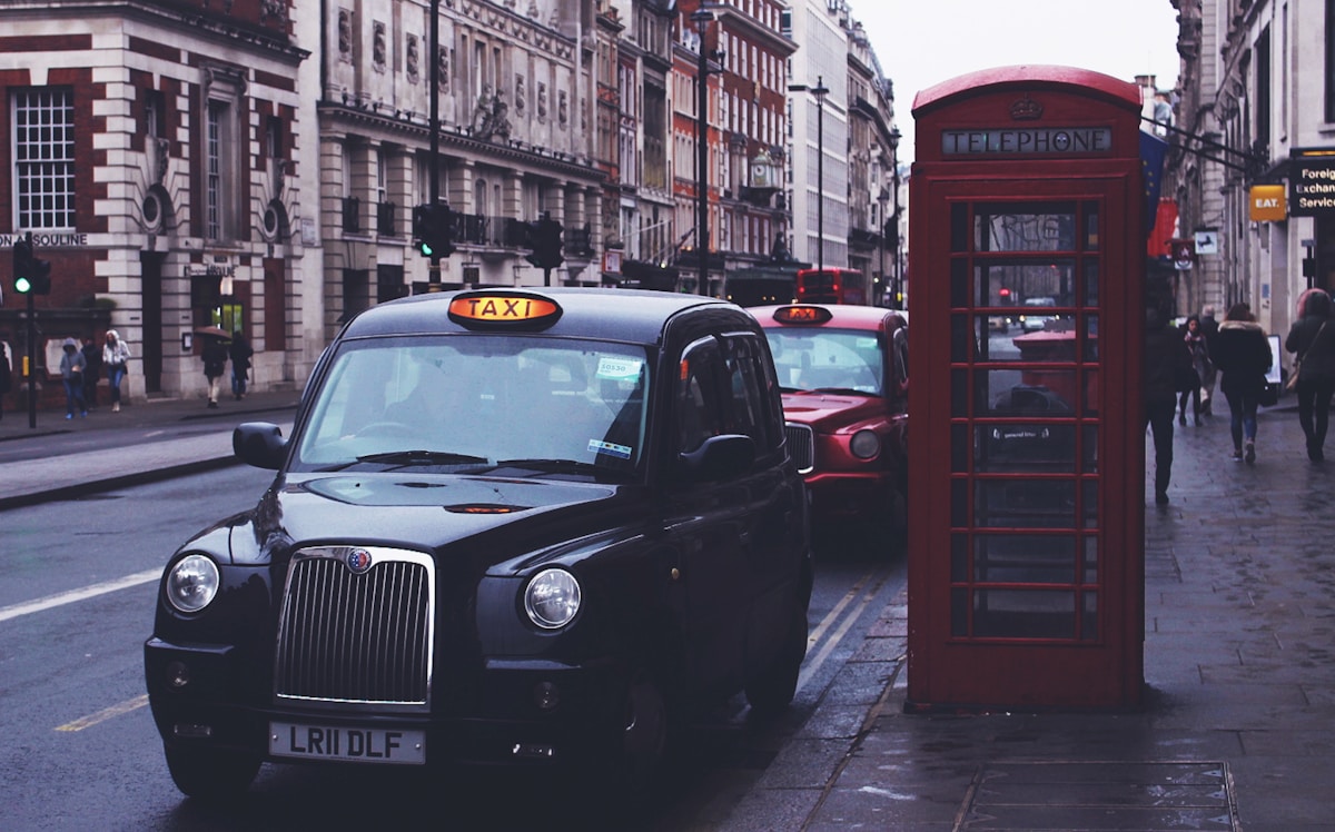
London’s black cabs are renowned worldwide for their exceptional service, largely due to the rigorous training drivers undergo known as ‘The Knowledge.’
This extensive examination requires drivers to memorize over 25,000 streets and 20,000 landmarks within a six-mile radius of Charing Cross.
Mastering The Knowledge typically takes three to four years, ensuring that London’s taxi drivers possess unparalleled expertise in maneuvering through the city’s complex street network.
The Knowledge: Understanding London’s World-Famous Taxi Service
London’s iconic black cabs are renowned for their convenience, accessibility, and the unparalleled local expertise of their drivers.
When maneuvering through the city, particularly during peak hours or in areas with limited public transport options, hailing a black cab can be an efficient choice.
To guarantee a smooth experience, familiarize yourself with proper taxi etiquette, such as queuing at designated taxi ranks, clearly communicating your destination, and having payment ready upon arrival.
When to Choose a Black Cab: Convenience, Accessibility, and Local Expertise
When traversing the bustling streets of London, discerning travelers often face the decision of whether to hail one of the city’s iconic black cabs, a choice that hinges on factors such as convenience, accessibility, and the desire for local expertise.
Black cabs excel in situations where:
- Time is of the essence
- Accessibility for disabled passengers is essential
- Navigation through complex or unfamiliar areas is needed
These factors make black cabs an appealing option for those seeking a reliable and informed transport experience in London.
Taxi Etiquette: Tips for a Smooth Black Cab Experience
Starting on a journey in one of London’s iconic black cabs requires more than just waving your arm; it involves understanding and adhering to a set of unwritten rules that guarantee a pleasant experience for both passengers and drivers alike.
Be clear about your destination, avoid eating or drinking in the cab, and engage in polite conversation if initiated.
Tipping is customary but not mandatory, typically around 10-15% of the fare.
Cycling in the City: Santander Cycles (Boris Bikes)

London’s Santander Cycles, colloquially known as ‘Boris Bikes‘, offer an affordable and eco-friendly way to navigate the city’s streets.
This public bicycle sharing system, launched in 2010, provides over 11,500 bikes across 750 docking stations throughout central London.
Visitors and locals alike can easily rent a bike using a credit card or the official app, making it a convenient option for short trips or leisurely rides through the capital’s parks and attractions.
Pedaling Through London: Your Guide to the City’s Bike Share Scheme
London’s bike-sharing program, Santander Cycles (commonly known as Boris Bikes), offers an eco-friendly and cost-effective way to explore the city.
This guide will provide essential information on how to locate and rent a Santander Cycle, ensuring a smooth start to your cycling journey.
Additionally, we’ll cover important safety guidelines, recommended routes, and best practices for maneuvering London’s bustling streets on two wheels.
Finding and Renting a Santander Cycle: A Step-by-Step Guide
Steering through London’s bustling streets on two wheels becomes effortless with the city’s extensive Santander Cycles network, a popular bike-sharing scheme that offers both residents and visitors a convenient and eco-friendly transportation option.
To rent a Santander Cycle:
- Locate a docking station using the official app or website
- Select ‘Hire a cycle’ at the terminal
- Choose your rental period and payment method
Cycling Safely in London: Rules, Routes, and Best Practices
To guarantee a safe and enjoyable cycling experience in London’s bustling streets, it is crucial to familiarize yourself with the city’s cycling rules, recommended routes, and best practices before setting out on your Santander Cycle.
Always ride on the left, obey traffic signals, and use hand signals when turning. Stick to designated cycle lanes and quieter streets when possible.
Wear a helmet, stay visible, and remain alert to your surroundings.
Walking in London: The Often Overlooked Transport Option

Walking in London offers a unique perspective on the city’s rich history and vibrant culture.
Numerous walking routes crisscross the capital, revealing hidden gems and lesser-known attractions that are often missed when using other modes of transport.
From the serene Thames Path to the bustling streets of Soho, exploring London on foot allows visitors to uncover the city’s intricate details and local charm at their own pace.
Exploring London on Foot: Walking Routes and Hidden Gems
London’s extensive walking infrastructure offers a plethora of options for exploring the city on foot, from picturesque pedestrianized streets to scenic river walks along the Thames.
Numerous walking apps and digital resources provide invaluable assistance to urban explorers, offering curated routes, historical insights, and real-time navigation.
These technological tools, combined with London’s well-designed pedestrian pathways, make walking an efficient and often overlooked transport option for both locals and visitors seeking to uncover the city’s hidden gems.
London’s Walking Infrastructure: From Pedestrianized Streets to River Walks
Bustling streets and picturesque riverside paths form the backbone of London’s extensive walking infrastructure, offering visitors and residents alike an often-overlooked way to explore the city’s rich history and hidden gems.
The city’s pedestrian-friendly features include:
- Pedestrianized zones like Carnaby Street
- Thames Path for riverside strolls
- Historic alleyways in the City of London
These routes provide an intimate, cost-free way to experience London’s diverse neighborhoods and landmarks, allowing for spontaneous discoveries and a deeper connection with the urban landscape.
Walking Apps and Resources: Tech Tools for Urban Explorers
To complement the city’s extensive walking infrastructure, a plethora of digital tools and resources have emerged, empowering urban explorers to navigate London’s intricate network of streets and pathways with ease and confidence.
Apps like Citymapper and Google Maps offer real-time navigation, while specialized platforms such as Go Jauntly and Hidden London Walks reveal lesser-known routes and secret spots.
These resources allow adventurers to uncover the city’s hidden gems and chart their own course through London’s diverse neighborhoods.
Accessibility in London’s Public Transport System

London’s public transport system has made significant strides in improving accessibility for all passengers.
Transport for London (TfL) provides extensive resources and services to assist those with mobility, visual, auditory, or cognitive impairments.
From step-free access at many Underground stations to audio-visual announcements on buses and trains, London’s transport network aims to guarantee that everyone can navigate the city with ease and independence.
A Guide to Accessibility in London’s Public Transport System
London’s public transport system offers extensive accommodations for passengers with disabilities, ensuring inclusive travel experiences.
The city’s buses, trains, and underground stations are equipped with features such as level access, wheelchair spaces, and audio-visual announcements to facilitate independent journeys.
These accessibility measures not only provide greater mobility for individuals with disabilities but also contribute to a more inclusive and diverse urban environment for all Londoners and visitors alike.
How to Use London’s Public Transport System with a Disability
While traversing London’s extensive public transport system can be challenging for anyone, individuals with disabilities have access to a range of accommodations and services designed to secure their travel experience is as smooth and accessible as possible.
Key features for disabled travelers include:
- Step-free access at many stations
- Priority seating and wheelchair spaces
- Audio-visual announcements
These provisions secure that London’s public transport remains inclusive, allowing individuals with disabilities to navigate the city with independence and confidence.
Key Benefits of London’s Accessible Public Transport System
Accessibility features in London’s public transport system offer numerous advantages to travelers with disabilities, enhancing their mobility and independence throughout the city.
These benefits include step-free access at many stations, priority seating, audio-visual announcements, and assistance services.
Wheelchair spaces on buses and dedicated areas on trains provide comfortable travel options.
The widespread availability of accessible transport empowers individuals with disabilities to explore London freely and confidently.
Smart Travel: Ticketing and Payment Options
London’s public transport system offers a range of modern ticketing and payment options to streamline travel.
The Oyster card, a reloadable smart card, provides a convenient way to pay for journeys across multiple modes of transport, including buses, trains, and the Underground.
For even greater flexibility, contactless payment methods using credit or debit cards, as well as mobile devices, have been widely adopted across the network, allowing travelers to simply tap and go without the need for a separate travel card.
Mastering London’s Transport Fares: From Oyster to Contactless
London’s public transport system offers a range of travel card options to suit different durations and usage patterns, including daily, weekly, and monthly passes.
These travel cards can be loaded onto an Oyster card or accessed through mobile ticketing apps, providing convenient digital solutions for commuters and visitors alike.
Understanding the benefits and limitations of each option is essential for travelers to optimize their transport costs and enjoy seamless journeys across the city.
Comparing Travel Cards: Daily, Weekly, and Monthly Options Explained
Maneuvering London’s extensive public transport system becomes more cost-effective with the strategic use of travel cards, which offer daily, weekly, and monthly options to suit various travel patterns and budgets.
These cards provide:
- Unlimited travel within selected zones
- Significant savings for frequent travelers
- Flexibility to use multiple transport modes
Choosing the right travel card depends on your length of stay and planned activities, ensuring you maximize your freedom to explore London while minimizing costs.
Mobile Ticketing: Apps and Digital Solutions for London Transport
In the digital age, travelers can now bypass physical cards entirely and opt for mobile ticketing solutions that offer even greater convenience and flexibility when maneuvering London’s transport network. Several apps provide digital alternatives:
| App Name | Features | Compatibility |
|---|---|---|
| TfL Go | Real-time updates, journey planning | iOS, Android |
| Citymapper | Multimodal routing, fare estimates | iOS, Android |
| Google Pay | Contactless payments, ticket storage | Android |
These solutions empower users with instant access to tickets and real-time travel information.
Planning Your Journey: Tools and Resources
In the age of smartphones, traversing London’s extensive transport network has become considerably easier with the help of essential apps.
These digital tools provide real-time updates, route planning, and ticketing information, making them indispensable for both tourists and locals.
Popular apps like Citymapper, TfL Go, and Google Maps offer thorough coverage of London’s buses, tubes, trains, and even bike-sharing services, ensuring travelers can efficiently plan their journeys across the city.
These kind of tools will be very important to help you getting around or even choose where to stay in London during your trip to mobilize quickly and efficiently.
Tech-Savvy Travel: Essential Apps for Navigating London’s Transport
In the digital age, several essential apps have revolutionized how travelers navigate London’s complex transport system.
These apps provide real-time updates on delays and disruptions across various modes of transportation, ensuring passengers can make informed decisions about their journeys.
Additionally, advanced journey planners integrated into these applications offer users the ability to find the fastest and most efficient routes, taking into account current traffic conditions, service interruptions, and alternative travel options.
Real-Time Updates: Staying Informed About Delays and Disruptions
Staying informed about real-time delays and disruptions is essential for efficiently traversing London’s extensive public transport network.
Travelers can access up-to-the-minute information through various channels:
- TfL’s official website and mobile app
- Twitter feeds for specific transport lines
- Digital display boards at stations and stops
These tools empower passengers to make informed decisions, adapt their routes, and minimize travel time, ensuring a smoother journey through London’s dynamic transportation landscape.
Journey Planners: Finding the Fastest and Most Efficient Routes
Journey planners have revolutionized the way travelers navigate London’s complex transportation network, offering powerful tools to find the fastest and most efficient routes across the city.
Apps like Citymapper and TfL Go provide real-time updates, multi-modal options, and personalized suggestions, empowering users to make informed decisions.
These digital assistants consider factors such as traffic, service disruptions, and walking distances, ensuring seamless journeys and maximizing your time exploring London’s vibrant streets.