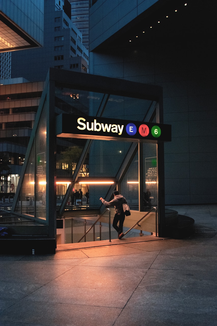
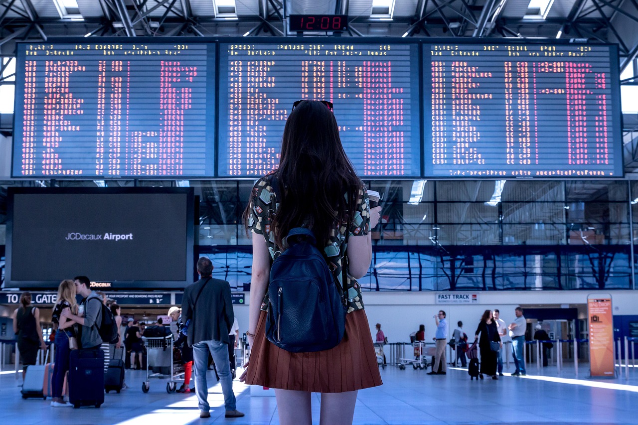
New York City offers a thorough transportation network for travelers. The subway system provides affordable, rapid transit throughout the boroughs, while buses reach areas beyond subway lines.
Visitors can pay fares using MetroCards or the contactless OMNY system. Ferries offer scenic routes connecting waterfront locations, and the Roosevelt Island Tramway provides unique aerial views.
Understanding rush hours (7-9 AM, 4-7 PM) and utilizing navigation apps guarantees smoother travel experiences throughout this bustling metropolis.
Key Takeaways
Understanding the Basics of New York Transportation
New York City offers one of the most extensive public transportation systems in the world, with subways, buses, ferries, and commuter rails serving all five boroughs.
Before maneuvering this vast network, travelers should familiarize themselves with essential terminology such as “uptown,” “downtown,” “express,” “local,” and “MetroCard.”
Understanding these basics will greatly enhance the visitor experience while minimizing confusion when moving throughout the city.
An Overview of Public Transportation in New York City
New York City offers an extensive public transportation network comprising subways, buses, and ferries that efficiently connect the five boroughs.
The subway system serves as the backbone of city travel, providing the fastest access to Manhattan attractions, Brooklyn neighborhoods, and key areas in Queens and the Bronx.
Ferries offer scenic routes to Staten Island and waterfront destinations, while buses complement the subway by reaching areas beyond walking distance from stations.
Types of transport available: subway, buses, ferries
Travelers in New York City have several efficient public transportation options to navigate the sprawling metropolis.
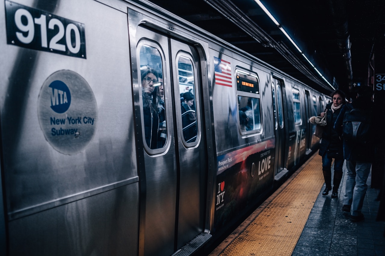
The New York subway system forms the backbone of public transportation in New York City, operating 24/7.
Buses complement the subway, reaching areas beyond subway lines.
Ferries offer scenic alternatives, connecting Manhattan with outlying boroughs while providing spectacular skyline views.
Areas of the city best accessed via public transit
Manhattan’s most iconic attractions are best accessed via the city’s extensive public transit system.
The Metropolitan Museum, Central Park, and Times Square are easily reached by subway.
For Brooklyn’s trendy neighborhoods and waterfront, transportation in New York City offers frequent options.
To maximize freedom while exploring, consider a New York public transport pass—essential for how to get around in New York efficiently.
Key Terms Every Traveler Should Know Before Using New York Public Transport
Maneuvering New York City’s public transportation system requires familiarity with key terminology that distinguishes between various service options.
Travelers should understand how subway lines are designated by numbers or letters and how uptown/downtown directions correspond to northbound and southbound travel, while transfers allow passengers to change between lines at connecting stations.
Equally important is recognizing the difference between express trains, which stop only at major stations, and local trains, which make all stops along their routes.
Understanding subway lines, directions, and transfers
New York City’s sprawling subway system serves as the lifeblood of the city, carrying over 5 million passengers daily across its 472 stations and 36 lines.
Understanding New York transportation requires grasping directional terminology: trains run “uptown” (north), “downtown” (south), and sometimes “crosstown” (east-west).
Métro New York transfers are typically free with subway tickets for tourists using the city public transportation system.
Read more: Best Time To Visit New York City
Differences between express and local services
One of the most essential distinctions travelers must understand when using NYC’s subway system is the difference between express and local services.
When getting around New York City, notice:
- Express trains skip stations, while local trains stop at every station.
- Express trains display diamond symbols; locals show circles.
- New York transport schedule boards indicate which public transportation service arrives next.
How to Use the Subway in New York Like a Local
Maneuvering New York’s subway system efficiently requires understanding its basic operations, route maps, and fare system.
Travelers can blend in with locals by following unspoken subway etiquette, including moving quickly through turnstiles and standing clear of closing doors.
Maintaining awareness of surroundings and securing personal belongings are essential safety practices that enhance the subway experience for visitors exploring the city.
Getting Started With the New York Subway
The New York City subway system offers tourists convenient MetroCards in various denominations, from single rides to unlimited weekly passes available at station kiosks and select retailers.
Guiding through the extensive subway network begins with understanding the color-coded map, where lines are distinguished by letters or numbers and directions are indicated as “uptown” (north) or “downtown” (south).
Efficient route planning requires identifying the nearest station to your starting point and destination, noting any necessary transfers between lines, and checking for weekend service changes that might affect your journey.
Tips for purchasing a New York Subway Pass for tourists
When planning a visit to New York City, purchasing the right subway pass can save tourists both money and frustration.
The best way to get around New York depends on length of stay and travel frequency.
- MetroCard – Standard transport New York option, available at subway stations
- OMNY – Tap-and-go payment system using smartphones or contactless cards
- 7-Day Unlimited – Ideal for travelers spending several days exploring New York transportation
How to read the subway map and plan your route
Understanding New York City’s subway map may seem overwhelming at first glance, but mastering this essential skill transforms visitors into confident travelers who move effortlessly through the city.
When planning your route to New York or figuring out how to get to New York attractions, focus on color-coded lines and train numbers/letters.
The map indicates local versus express stops with black and white circles.
Subway Etiquette and Safety Tips for Travelers
Maneuvering New York’s subway system during rush hour requires awareness of unspoken rules and personal safety.
Commuters should stand clear of closing doors, offer seats to elderly or pregnant passengers, and keep bags on laps or between feet rather than occupying additional seating.
Maintaining situational awareness, keeping valuables secure, and avoiding loud conversations or music helps travelers blend in with locals while ensuring a smoother subway experience.
What to expect during rush hour and how to stay alert
Rush hour in New York City transforms the subway into a high-density human traffic zone from 7:30-9:30 AM and 4:30-6:30 PM on weekdays.
Travelers should:
- Position themselves near doors before their stop
- Keep belongings close to prevent theft during crowding
- Consider alternative routes or waiting for less crowded trains
Standing clear of closing doors prevents delays and frustration from other commuters.
Rules for seating, noise, and large bags
Many subway etiquette rules remain unspoken yet essential for visitors to master.
Offer seats to elderly, pregnant, or disabled passengers. Keep bags on your lap or between feet to conserve space. Avoid loud conversations, music, or phone calls.
During crowded rides, remove backpacks and place them at your feet. Large luggage should be stored away from doors and high-traffic areas.
Exploring Other Modes of Public Transportation in New York
While the subway remains New York’s transportation backbone, the city offers several alternative public transit options worth discovering.
Manhattan’s extensive bus network provides aboveground travel with street-level views, while the NYC Ferry system connects waterfront neighborhoods across all five boroughs with invigorating harbor crossings.
For a truly memorable experience, the Roosevelt Island Tramway glides above the East River, offering spectacular panoramic vistas of the city skyline during its brief aerial journey.
Taking the Bus Across Manhattan and Beyond
New York’s extensive bus system offers travelers a convenient way to explore parts of the city less accessible by subway.
Passengers can pay their fare using either a MetroCard, available at subway stations, or any contactless payment card by simply tapping at the onboard reader.
Popular routes include the M1, which travels the length of Fifth Avenue with views of Central Park and Museum Mile, and the M42, which provides a convenient crosstown option with stops near major attractions.
How to pay using a MetroCard or contactless option
When boarding a city bus, passengers can use the same payment methods that serve the subway system.
Riders can pay their fare through:
- Traditional MetroCard – swipe at the fare box
- OMNY contactless payment – tap credit cards or smartphones
- Single-ride tickets – available from vending machines
This integrated payment system allows travelers to move freely throughout the city without purchasing separate tickets for different transit modes.
Popular bus routes for sightseeing and convenience
Now that travelers understand how to pay for bus travel, selecting the right routes can enhance the sightseeing experience greatly.
The M5 offers scenic rides along Fifth Avenue past Museum Mile.
For crosstown travel, the M42 connects Grand Central to the United Nations and Port Authority.
Meanwhile, the M4 provides access to Lincoln Center and the Metropolitan Museum.
NYC Ferries: A Scenic Way to Travel
The NYC Ferry system offers a revitalizing transportation alternative with routes connecting Manhattan to Brooklyn, Queens, and the Bronx for just $4 per ride.
Passengers enjoy spectacular skyline views while traveling to attractions like Governors Island, DUMBO, and Rockaway Beach without subway crowds or traffic congestion.
Ferries become particularly valuable during rush hour subway delays or when traveling between waterfront neighborhoods that would otherwise require multiple train transfers.
Routes, pricing, and attractions along the water
New York City’s ferry system offers travelers a rejuvenating alternative to subways and buses while providing stunning views of the iconic skyline.
For just $4 per ride, passengers can explore:
- East River Route – connecting Manhattan, Brooklyn, and Queens
- Rockaway Route – leading to scenic beaches and surfing spots
- Governors Island Route – accessing the car-free recreational haven
Monthly passes available for frequent riders.
When ferries are a better option than the subway
Timing plays an essential role when deciding between ferries and subways in New York City.
Ferries excel during rush hour when underground trains become packed with commuters. They’re also superior when traveling to waterfront destinations like Governor’s Island or DUMBO.
The unobstructed views of Manhattan’s skyline and Statue of Liberty make ferries the liberated traveler’s choice for memorable journeys.
Roosevelt Island Tramway: A Unique Commute with a View
The Roosevelt Island Tramway offers visitors a distinctive aerial perspective of Manhattan’s skyline while using the same MetroCard as the subway system.
Travelers can board the tram at its Manhattan terminal on 60th Street and Second Avenue, paying the standard MTA fare for a one-way ride.
Once on Roosevelt Island, passengers can easily connect to Manhattan via the F train or explore the island’s attractions before continuing their journey.
How to ride it using a subway pass
Riding the Roosevelt Island Tramway is remarkably convenient for visitors with a MetroCard, as the aerial gondola system fully integrates with New York City’s subway payment system.
To use this iconic aerial transport:
- Swipe your MetroCard at the turnstile, just as you would for the subway.
- Each ride costs one standard fare ($2.90).
- Unlimited MetroCards work for both subway and tram access.
Connecting to other parts of the city from Roosevelt Island
Once visitors arrive on Roosevelt Island via the tramway, connecting to other parts of New York City becomes straightforward through multiple transportation options.
The F train subway station links directly to Manhattan and Queens. Additionally, the NYC Ferry service offers scenic routes to various waterfront destinations.
For land-based alternatives, the Q102 bus crosses to Queens, providing Manhattan connections through transfer points.
Using Transit Passes to Save Money and Time
Travelers to New York City can maximize their budget and efficiency by selecting the appropriate transit pass for their itinerary.
The MetroCard offers various options including pay-per-ride, unlimited 7-day, and 30-day passes, while the newer OMNY contactless payment system provides tap-and-go convenience.
Visitors can purchase MetroCards from vending machines located in every subway station, at select retailers, or through the MTA’s official website.
Choosing the Right New York Transportation Pass
Travelers to New York City face key decisions about transit passes that impact both budget and convenience.
The Unlimited Ride MetroCard offers unlimited subway and bus trips for a fixed period, while the Pay-Per-Ride option charges per journey with a small discount for multiple rides.
The newer OMNY contactless payment system provides flexibility for short-term visitors who prefer using their own credit cards or mobile devices rather than purchasing a physical MetroCard.
Differences between the Unlimited Ride MetroCard and Pay-Per-Ride
When traversing New York City’s extensive transit system, visitors face an essential decision between two primary MetroCard options: the Unlimited Ride MetroCard and the Pay-Per-Ride MetroCard.
The key differences include:
- Unlimited Ride offers infinite trips for a fixed period (7-day/$33 or 30-day/$127)
- Pay-Per-Ride charges $2.75 per trip with a 5% bonus for $5.50+ purchases
- Break-even point occurs around 12 rides for the 7-day pass
When to consider the OMNY contactless system
The future of transit payment has arrived in New York City with OMNY (One Metro New York), the MTA’s contactless fare payment system that eliminates the need for physical MetroCards.
Travelers should consider OMNY when making spontaneous trips or staying briefly.
Simply tap credit cards or smartphones at turnstiles for the same $2.90 fare. Without purchase lines or card management, OMNY offers ultimate convenience for those valuing flexibility.
Where to Buy Subway Tickets for Tourists
Tourists can purchase MetroCards from automated vending machines located in every subway station, at authorized retailers like select newsstands and convenience stores, or through the MTA’s official mobile app.
After purchasing a card, travelers should avoid bending it or exposing it to extreme temperatures, which can damage the magnetic strip and render it unusable.
Keeping the MetroCard in a protective case or dedicated wallet pocket will help maintain its functionality and prevent costly replacements during a New York visit.
Vending machines, authorized locations, and mobile apps
Purchasing transit passes in New York City has never been easier with multiple convenient options available to visitors.
Travelers can obtain MetroCards through:
- Automated vending machines at subway stations accepting cash and cards.
- Official retail partners including convenience stores and newsstands throughout the city.
- OMNY contactless payment system using smartphones or contactless credit cards for tap-and-go access.
Tips for keeping your card safe and functional
Once visitors have acquired their MetroCards or set up OMNY payments, protecting these transit passes becomes a key concern.
Travelers should avoid bending MetroCards or exposing them to magnets and electronic devices. Store cards in protective sleeves, separate from phones and credit cards.
For OMNY users, enabling screen locks and maintaining device battery life guarantees uninterrupted transit access throughout the city.
Alternative and Eco-Friendly Ways to Get Around New York
New York City offers several eco-friendly transportation options beyond the subway and bus systems.
Visitors can explore the city on foot, rent Citi Bikes from hundreds of stations throughout the boroughs, or use ride-sharing apps and traditional taxi services when needed.
These alternatives provide flexibility while reducing one’s carbon footprint in America’s most walkable city.
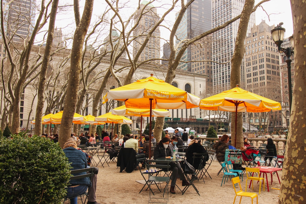
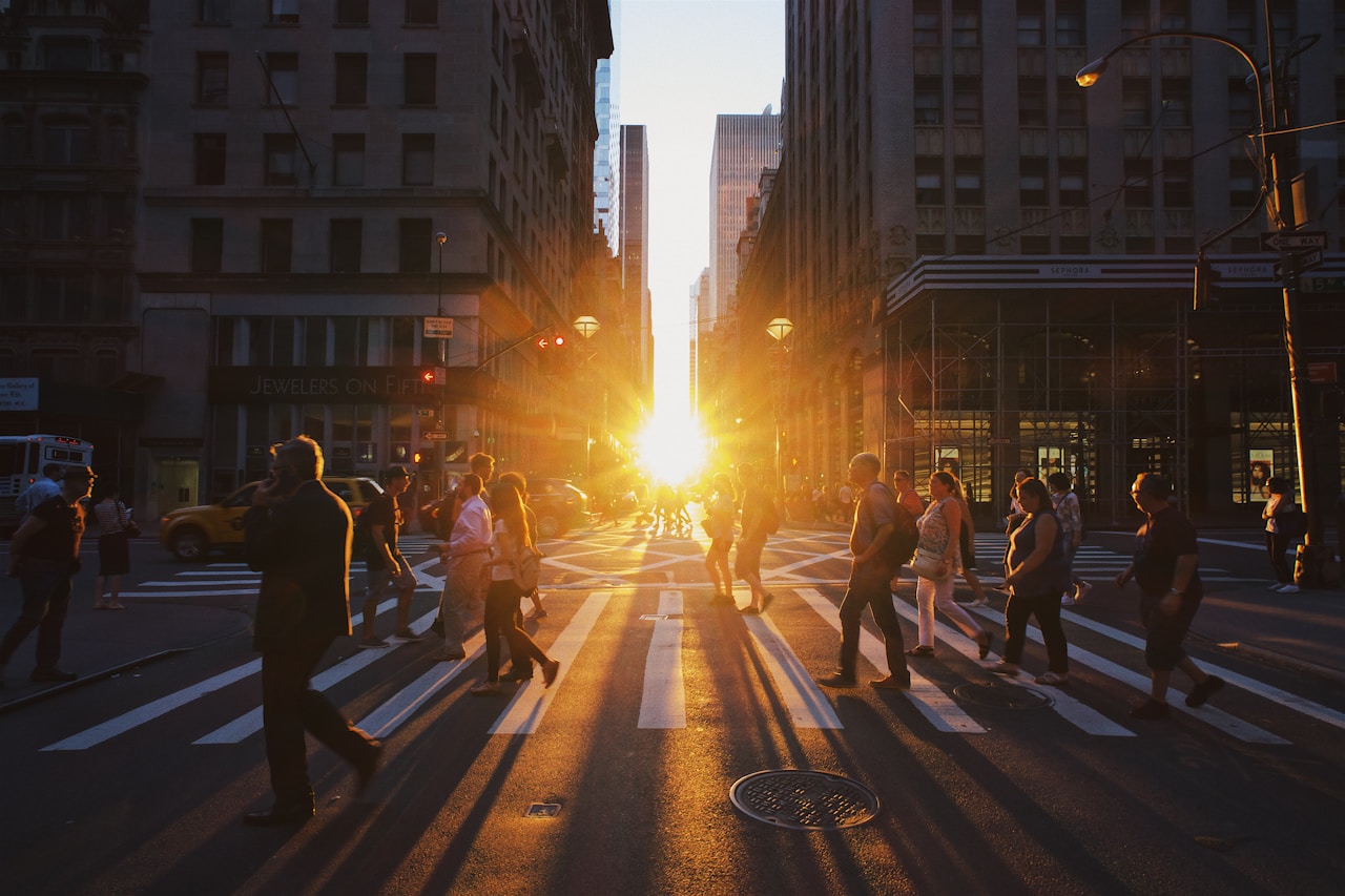
Walking: One of the Best Ways to Explore NYC
Walking through New York City offers travelers an intimate glimpse into the city’s diverse neighborhoods, with Greenwich Village, Chelsea, and the High Line providing especially rewarding pedestrian experiences.
Visitors should prioritize safety by using crosswalks, obeying traffic signals, and remaining aware of their surroundings, particularly in busier areas like Midtown and Times Square.
Popular walking routes include the Brooklyn Bridge pathway, the Museum Mile along Fifth Avenue, and the scenic Hudson River Greenway, all offering distinctive perspectives of the city’s architecture and culture.
Neighborhoods ideal for walking and sightseeing
For travelers intent on exploring New York City by foot, certain neighborhoods stand out as particularly walkable and rewarding for sightseeing.
These pedestrian-friendly areas offer the authentic NYC experience:
- Greenwich Village – Winding streets filled with historic architecture and cultural landmarks
- High Line/Chelsea – Elevated park with art galleries and Hudson River views
- Lower Manhattan – Financial District, Chinatown, and Brooklyn Bridge access
Pedestrian safety and common walking routes
While exploring the concrete jungle of New York City on foot offers unparalleled opportunities to absorb the city’s lively atmosphere, travelers should prioritize pedestrian safety and familiarity with common walking routes.
| Safety Tips | Popular Routes |
|---|---|
| Cross at crosswalks | High Line Park |
| Follow pedestrian signals | Brooklyn Bridge |
| Stay alert, avoid phone distractions | Central Park loops |
| Walk with purpose, particularly at night | Fifth Avenue shopping |
| Maintain awareness in crowded areas | Hudson River Greenway |
Biking Through the City Using Citi Bike
Citi Bike offers travelers a convenient option for traversing New York City with over 1,500 stations across Manhattan, Brooklyn, Queens, and the Bronx.
Visitors can easily rent bikes through the Citi Bike app or at kiosk stations, paying for single rides or purchasing day passes that allow unlimited 30-minute trips.
For safety and scenic views, tourists should prioritize protected bike paths like those along the Hudson River Greenway, through Central Park, or over the Brooklyn Bridge.
How to rent and return bikes at various stations
Many travelers find Citi Bike, New York City’s bike-sharing program, to be an efficient and enjoyable way to navigate the city.
Renting and returning bikes is straightforward:
- Download the Citi Bike app and purchase a pass
- Access bikes at any station by entering your code or using the app
- Return bikes to any station by firmly docking until green light appears
Suggested paths and bike lanes for tourists
New York City offers an extensive network of bike lanes and scenic routes perfect for tourists exploring on two wheels.
The Hudson River Greenway provides waterfront views from Battery Park to Inwood, while the Central Park loop offers a car-free oasis.
Brooklyn Bridge crossing delivers iconic skyline vistas, and the protected lanes along 1st and 2nd Avenues connect major attractions safely.
Ride-Share and Taxi Services for Convenience
Travelers should consider both yellow cabs and rideshare services like Uber based on their specific circumstances in New York City.
Yellow taxis often prove more economical in Manhattan during non-surge pricing periods, while rideshare services excel in outer boroughs or when cabs are scarce.
During peak hours or inclement weather, setting pickup locations at less congested side streets and allowing extra time can greatly improve the rideshare experience.
When to use Uber in New York vs. yellow cabs
When deciding between Uber and traditional yellow cabs in New York City, visitors should consider several factors including cost, convenience, and travel circumstances.
- Rush hour: Yellow cabs excel during peak times as they can be hailed instantly, while Uber might have surge pricing.
- Late night: Uber offers reliable service when cabs are scarce.
- Outer boroughs: Rideshare apps typically provide better coverage beyond Manhattan.
Best practices for calling a car during busy hours
Maneuvering New York City during rush hours requires strategic planning to secure timely transportation.
Savvy travelers book rides 15-20 minutes in advance during peak times (7-9am, 4-7pm) and position themselves on less congested side streets.
| Time Period | Recommended Service | Average Wait Time |
|---|---|---|
| Morning Rush | Pre-scheduled Uber | 10-15 minutes |
| Midday | Yellow Cab | 5-10 minutes |
| Evening Rush | Lyft | 15-20 minutes |
| Late Night | Via | 8-12 minutes |
Getting to and From the City Like a Pro
Maneuvering to Manhattan from regional airports and nearby cities requires understanding the most efficient transit connections.
Travelers can choose from trains, buses, car services, and ferries depending on their arrival point and final destination.
Each route option offers different trade-offs between cost, travel time, and convenience for those entering the bustling heart of New York City.
How to Get to New York From Airports and Nearby Cities
New York’s three major airports—JFK, LaGuardia, and Newark—offer travelers multiple transportation options to reach Manhattan and surrounding boroughs.
Visitors can choose between public transit such as subway connections and airport express buses, dedicated airport shuttles, or private car services depending on budget, luggage amount, and time constraints.
Regional trains from nearby cities including Boston, Philadelphia, and Washington DC provide convenient alternatives to flying, with direct service to Penn Station or Grand Central Terminal in the heart of Manhattan.
JFK, LaGuardia, and Newark transport options
Travelers arriving in the New York metropolitan area have three major airports to evaluate: John F. Kennedy International (JFK), LaGuardia (LGA), and Newark Liberty International (EWR).
Each offers distinct transportation options:
- JFK: AirTrain to subway/LIRR ($8-15, 50-75 minutes)
- LaGuardia: Q70 bus to subway or taxi ($2.75-45, 35-60 minutes)
- Newark: AirTrain to NJ Transit ($15-20, 45 minutes)
Trains, shuttles, and private services
Beyond the immediate airport options, visitors to New York City can utilize various regional trains, shuttle services, and private transportation methods to access the city from surrounding areas.
Amtrak connects NYC with Boston, Philadelphia, and Washington DC.
NJ Transit and Metro-North serve New Jersey and Connecticut respectively.
Door-to-door shuttles offer fixed-rate alternatives to taxis, while ride-sharing services provide flexible transportation throughout the region.
Route Options for Travelers Coming Into Manhattan
Travelers entering Manhattan have several rail options including Amtrak for long-distance journeys, NJ Transit from New Jersey, and Long Island Rail Road (LIRR) from eastern suburbs and JFK Airport.
Penn Station serves all three rail lines and sits beneath Madison Square Garden, offering immediate access to multiple subway lines despite its notoriously confusing layout.
Grand Central Terminal, primarily serving Metro-North commuters from upstate New York and Connecticut, provides a more architecturally impressive arrival experience with its soaring ceilings, famous clock, and convenient access to the east side of Manhattan.
Using Amtrak, NJ Transit, or Long Island Rail Road
For those journeying to Manhattan from surrounding states or distant parts of New York, regional rail services provide efficient alternatives to driving or flying.
Three key rail options include:
- Amtrak – Connects major cities with Penn Station
- NJ Transit – Links New Jersey communities to Midtown
- LIRR – Serves Long Island residents with frequent service to Penn Station and Grand Central
What to expect at Penn Station and Grand Central
New York’s two major transportation hubs, Penn Station and Grand Central Terminal, serve as bustling gateways for millions entering Manhattan daily.
Penn Station, primarily underground beneath Madison Square Garden, connects Amtrak, LIRR, and NJ Transit routes.
Grand Central, an architectural masterpiece with its celestial ceiling, offers Metro-North service and abundant dining options in its elegant marble-clad concourse.
Tips for Stress-Free City Transportation
Traveling through New York City efficiently requires strategic timing to avoid the crushing crowds of rush hours, typically from 7-9 AM and 4-7 PM on weekdays.
Savvy travelers can enjoy more comfortable transit experiences by planning activities during mid-morning, early afternoon, or after 8 PM when subway cars and buses are less congested.
Several essential mobile applications—including the MTA’s official app, Google Maps, and Citymapper—provide real-time updates on service changes, delays, and the fastest routes between destinations.
Best Times to Travel Around New York City
Maneuvering New York City efficiently requires strategic timing to avoid the crush of morning and evening rush hours from 7-9am and 4-7pm.
Weekend subway service often runs on modified schedules with planned maintenance work that can cause unexpected delays or route changes.
Late-night travelers should note that while the subway operates 24/7, service becomes less frequent after midnight with longer wait times between trains.
Avoiding delays during peak commuter hours
Jammed between throngs of commuters during rush hour, travelers in New York City can find themselves losing precious vacation time to unexpected delays.
Savvy visitors maximize their urban liberty by strategically planning movement:
- Avoid subway travel between 7:30-9:30am and 4:30-6:30pm
- Book attractions near your accommodation during peak hours
- Use water taxis or Citi Bikes to bypass gridlocked streets
Night and weekend schedules to keep in mind
While weekday rush hours present obvious challenges, New York City’s transportation rhythms shift dramatically during nights and weekends, requiring travelers to adjust their expectations accordingly.
Subway service typically runs every 20 minutes after 10pm, with many lines changing routes. Weekend track work causes frequent disruptions.
Buses follow Sunday schedules on holidays. Consider ride-sharing services as convenient alternatives during these off-peak periods.
Apps and Tools to Help Navigate New York Transit
Finding one’s way through New York City’s extensive transit system becomes considerably easier with the right digital tools at hand.
Travelers can access real-time updates for subway arrivals and bus locations through official MTA apps and third-party options like Citymapper or Transit.
Mobile maps and route planners specifically designed for visitors offer customized navigation that accounts for service changes, construction delays, and the fastest paths to popular attractions.
Real-time subway and bus trackers
Real-time tracking technology has transformed how travelers experience New York City’s expansive subway and bus networks.
Several reliable apps provide up-to-the-minute transit information:
- MTA’s official app delivers accurate arrival predictions and service alerts
- Citymapper offers detailed route planning with alternative options
- Transit App displays nearby vehicles with color-coded lines for quick identification
Mobile maps and route planners for visitors
How can visitors traverse New York City’s complex transit landscape with confidence? Mobile maps and route planners offer liberation from confusion.
These digital tools provide real-time navigation, alternative routes, and service alerts.
| App | Key Features | Offline Capability |
|---|---|---|
| Google Maps | Transit directions, walking times | Limited |
| Citymapper | Multi-modal routes, rain-safe options | No |
| Transit | Real-time arrivals, trip planning | Yes |
Wrapping Up
As the traveler slips her MetroCard into her pocket, the same pocket where she’d tucked her grandmother’s old photo of Times Square from 1965, she realizes that while New York’s transportation systems have evolved, the rhythm of the city remains unchanged.
Maneuvering New York isn’t just about reaching destinations—it’s about joining the perpetual dance of eight million people moving as one magnificent organism.
Frequently Asked Questions (FAQs)
You can pay using two main systems:
-
MetroCard – A physical card used for subways and buses. Available as pay-per-ride or unlimited (7-day or 30-day options).
-
OMNY – A contactless payment system that allows you to tap your credit/debit card or smartphone at turnstiles and bus readers for a $2.90 fare.
-
Express trains skip multiple stops and only stop at major stations. They are marked with diamond symbols.
-
Local trains stop at every station along the line and are marked with circle symbols.
To avoid crowded trains and long waits:
-
Avoid: 7:00–9:00 AM and 4:00–7:00 PM on weekdays (rush hour)
-
Best times to travel: Mid-morning, early afternoon, or after 8:00 PM
On weekends, check transit apps for service changes due to maintenance.

A. Ardiansyah, a passionate explorer and travel writer at GetOutTrip, bringing destinations to life with every story.